POBIERANIE ZDJĘĆ...

Ziemia (Na sprzedaż)
2 000 m²
Źródło:
EDEN-T96119558
/ 96119558
Źródło:
EDEN-T96119558
Kraj:
PT
Miasto:
Aveiro
Kategoria:
Mieszkaniowe
Typ ogłoszenia:
Na sprzedaż
Typ nieruchomości:
Ziemia
Wielkość nieruchomości:
2 000 m²
CENA NIERUCHOMOŚCI OD M² MIASTA SĄSIEDZI
| Miasto |
Średnia cena m2 dom |
Średnia cena apartament |
|---|---|---|
| Oliveira do Bairro | 3 930 PLN | - |
| Aveiro | 4 525 PLN | 5 886 PLN |
| Dystrykt Aveiro | 4 484 PLN | 5 323 PLN |
| Ílhavo | 4 779 PLN | 5 388 PLN |
| Vagos | - | 4 682 PLN |
| Gafanha da Nazaré | 5 972 PLN | 7 841 PLN |
| Oliveira de Azeméis | 4 038 PLN | - |
| Ovar | 4 659 PLN | 4 696 PLN |
| Dystrykt Coimbra | 4 836 PLN | 5 801 PLN |
| Feira | 4 250 PLN | 3 539 PLN |
| Ovar | 4 964 PLN | 4 933 PLN |
| Coimbra | 4 866 PLN | 6 568 PLN |
| Santa Maria da Feira | 4 372 PLN | - |
| Dystrykt Viseu | 4 084 PLN | 5 653 PLN |
| Espinho | - | 9 284 PLN |
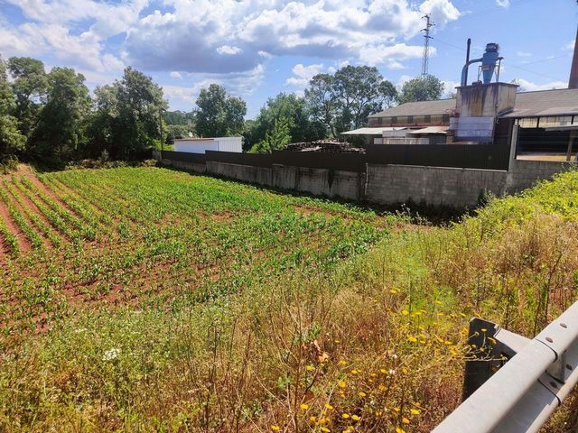
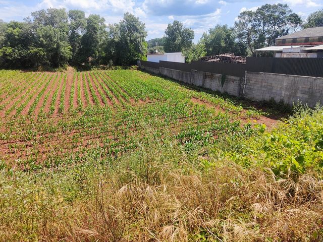
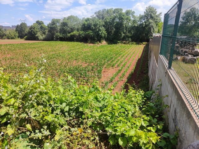
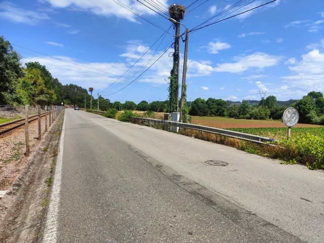
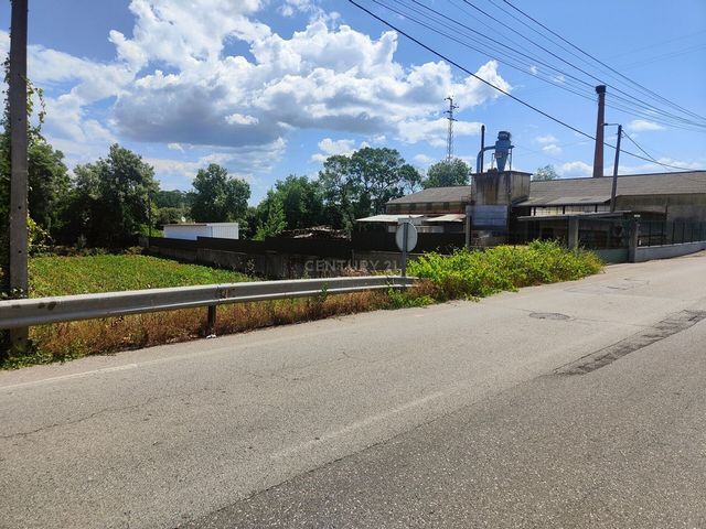
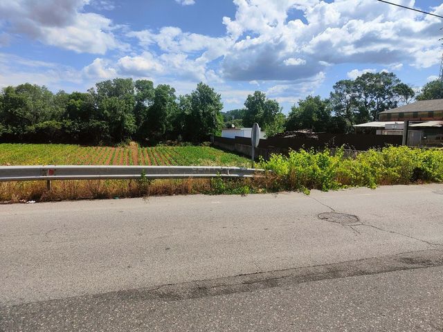
Confrontations: North and South with private land, East Rio Vouga and West Rua Manuel Lopes Póvoa
Located in a low-density residential area (villas)
Flat land with 40 meters in front with the sole purpose of cultivation, according to the Municipal Regulation in force (PDM)Already in 1839, it appears integrated in the comarca of Aveiro, although belonging to the municipality of Segadães. In 1852, in the region of Eixo, in 1862 in the region of Aveiro and in 1878 in the judgment of Requeixo. As for the name of this place, it may have something to do with the word Eiró eel or species of eel, found in abundance and that spreads in the estuary marking the very toponym of Aveiro (Ave e Eiró). Another explanation comes from the existence of old threshing floors destined to the drying of cereals, justified by the location of the parish on the left bank of the river Vouga and the cereal culture that benefits from the quality of the alluvial soils and the climatic traits that it presents. In this regard, in the literature, Eirol is referred to as a land fertile in all kinds of agriculture. As well as existing cattle raising for export. This is a rural activity that has accompanied the evolution of the parish whose seat, perched over the valley, uncovers a rural activity from which stand out the ancient cultures of corn and rice and the fragility of the swampy soils, of the marsh type, which gain expression in the neighboring parishes of Requeixo and Fermentelos. It is, therefore, a town centered on agriculture and the simple life of its former inhabitants, concentrated around the old church built with stone from the region and which serves as a reference for customers and those who inhabit the same valley. In addition to rural activities, this parish also contains remains of red sandstone or sandstone operations the Eirol sandstone used in the construction of Farol da Barra. These deposits from the Triassic and Cretaceous serve as an escarpment on the bed of the Vouga river, between Eirol and Eixo, which after this location continues in a valley widened by Angeja and Cacia. Being a land rich in water, a reference must be made to Ponte da Rata with its three-span aqueduct over the River Águeda, which serves to recall the violent floods and the flow of water from downstream to upstream, which are felt in this region. aria from the Vouga basin. Before its construction, the crossing of the river was done by means of a crossing barge. Later, access to this parish was facilitated by the Vouga line, an infrastructure that could transport new inhabitants who wanted to enjoy, in the "eagle's nest" type village or in neighboring places, the rural landscape allowed by the valley and by the vegetation. of the Águeda and Vouga rivers. Zobacz więcej Zobacz mniej Rustikales Grundstück in der Rua Manuel Lopes Póvoa in Eirol - Aveiro mit folgenden Eigenschaften:Gesamtfläche: 2.000 m2
Konfrontationen: Nord und Süd mit Privatland, Ost Rio Vouga und West Rua Manuel Lopes Póvoa
Das Hotel liegt in einer Wohngegend mit geringer Dichte (Villen)
Flaches Land mit 40 Metern Vorsprung zum alleinigen Zweck der Bewirtschaftung, gemäß der geltenden Gemeindeverordnung (PDM)Bereits 1839 erscheint es in der Comarca von Aveiro integriert, obwohl es zur Gemeinde Segadães gehört. 1852 in der Region Eixo, 1862 in der Region Aveiro und 1878 im Urteil von Requeixo. Was den Namen dieses Ortes betrifft, so könnte er etwas mit dem Wort Eiró-Aal oder Aalart zu tun haben, das in Hülle und Fülle vorkommt und sich in der Flussmündung ausbreitet, die den Ortsnamen von Aveiro (Ave e Eiró) markiert. Eine andere Erklärung ergibt sich aus dem Vorhandensein alter Tennen, die für die Trocknung von Getreide bestimmt waren, was durch die Lage der Gemeinde am linken Ufer des Flusses Vouga und die Getreidekultur gerechtfertigt ist, die von der Qualität der Schwemmböden und den klimatischen Merkmalen, die sie aufweisen, profitiert. In diesem Zusammenhang wird Eirol in der Literatur als ein Land bezeichnet, das für alle Arten von Landwirtschaft fruchtbar ist. Sowie die bestehende Viehzucht für den Export. Es handelt sich um eine ländliche Aktivität, die die Entwicklung der Pfarrei begleitet hat, deren Sitz, der über dem Tal thront, eine ländliche Aktivität freilegt, von der sich die alten Kulturen von Mais und Reis und die Zerbrechlichkeit der sumpfigen Böden des Sumpftyps abheben, die in den benachbarten Gemeinden Requeixo und Fermentelos zum Ausdruck kommen. Es handelt sich also um eine Stadt, die sich auf die Landwirtschaft und das einfache Leben ihrer ehemaligen Bewohner konzentriert, die sich um die alte Kirche konzentriert, die aus Steinen aus der Region gebaut wurde und als Referenz für Kunden und Bewohner desselben Tals dient. Neben den ländlichen Aktivitäten gibt es in dieser Gemeinde auch Überreste von rotem Sandstein oder Sandsteinarbeiten, dem Eiroler Sandstein, der beim Bau von Farol da Barra verwendet wurde. Diese Ablagerungen aus der Trias und Kreidezeit dienen als Steilhang im Flussbett der Vouga zwischen Eirol und Eixo, der sich danach in einem von Angeja und Cacia erweiterten Tal fortsetzt. Da es sich um ein wasserreiches Land handelt, muss Ponte da Rata mit seinem dreifeldrigen Aquädukt über den Fluss Águeda erwähnt werden, das an die heftigen Überschwemmungen und den Wasserfluss von flussabwärts nach flussaufwärts erinnert, die in dieser Region zu spüren sind. Arie aus dem Vouga-Becken. Vor dem Bau erfolgte die Überquerung des Flusses mit einem kreuzenden Lastkahn. Später wurde der Zugang zu dieser Gemeinde durch die Vouga-Linie erleichtert, eine Infrastruktur, die neue Einwohner transportieren konnte, die in einem Dorf vom Typ "Adlerhorst" oder in benachbarten Orten die ländliche Landschaft genießen wollten, die das Tal und die Vegetation ermöglichten. der Flüsse Águeda und Vouga. Terrain rustique sur la Rua Manuel Lopes Póvoa à Eirol - Aveiro avec les caractéristiques suivantes : Superficie totale : 2 000 m2
Confrontations : Nord et Sud avec des terrains privés, East Rio Vouga et West Rua Manuel Lopes Póvoa
Situé dans une zone résidentielle à faible densité (villas)
Terrain plat avec 40 mètres en façade dans le seul but de culture, selon le règlement municipal en vigueur (PDM)Déjà en 1839, il apparaît intégré dans la comarca d'Aveiro, bien qu'appartenant à la municipalité de Segadães. En 1852, dans la région d'Eixo, en 1862 dans la région d'Aveiro et en 1878 dans le jugement de Requeixo. Quant au nom de ce lieu, il pourrait avoir quelque chose à voir avec le mot Eiró anguille ou espèce d'anguille, trouvée en abondance et qui se répand dans l'estuaire marquant le toponyme même d'Aveiro (Ave e Eiró). Une autre explication vient de l'existence d'anciennes « aires de battage » destinées au séchage des céréales, justifiée par la situation de la paroisse sur la rive gauche de la rivière Vouga et la culture céréalière qui bénéficie de la qualité des sols alluviaux et du climat traits qu'il présente. À cet égard, dans la littérature, Eirol est désigné comme une terre fertile dans toutes sortes d'agriculture. Ainsi que l'élevage de bétail existant pour l'exportation. Il s'agit d'une activité rurale qui a accompagné l'évolution de la paroisse dont le siège, perché sur la vallée, dévoile une activité rurale dont se détachent les anciennes cultures de maïs et de riz et la fragilité des sols marécageux, de type marais, qui s'exprimer dans les paroisses voisines de Requeixo et Fermentelos. C'est donc une ville centrée sur l'agriculture et la vie simple de ses anciens habitants, concentrée autour de l'ancienne église construite en pierre de la région et qui sert de référence aux clients et à ceux qui habitent la même vallée. En plus des activités rurales, cette paroisse contient également des vestiges d'exploitations de grès rouge ou de grès - le grès d'Eirol - utilisés dans la construction de Farol da Barra. Ces dépôts du Trias et du Crétacé servent d'escarpement sur le lit de la rivière Vouga, entre Eirol et Eixo, qui après cet emplacement se poursuit dans une vallée élargie par Angeja et Cacia. Étant une terre riche en eau, il faut faire référence à Ponte da Rata avec son aqueduc à trois travées sur la rivière Águeda, qui sert à rappeler les violentes inondations et le flux d'eau d'aval en amont, qui se font sentir dans cette région. .air du bassin de la Vouga. Avant sa construction, la traversée du fleuve se faisait au moyen d'une barge de franchissement. Plus tard, l'accès à cette paroisse a été facilité par la ligne Vouga, une infrastructure qui pouvait transporter de nouveaux habitants qui voulaient profiter, dans le village de type "nid d'aigle" ou dans les localités voisines, du paysage rural permis par la vallée et par la végétation. des rivières Águeda et Vouga. Terreno rústico na Rua Manuel Lopes Póvoa em Eirol - Aveiro com as seguintes características: Área total: 2.000 m2
Confrontações: a Norte e Sul com terrenos privados, a Nascente Rio Vouga e a Poente Rua Manuel Lopes Póvoa
Localizado em área residencial de baixa densidade (moradias)
Terreno plano com 40 metros de frente com única finalidade de cultivo, segundo o Regulamento Municipal em vigor (PDM)Já em 1839, esta freguesia aparece integrada na comarca de Aveiro, embora pertencente ao concelho de Segadães. Em 1852, na comarca de Eixo, em 1862 na comarca de Aveiro e em 1878 no julgado de Requeixo. Entretanto, é de registar uma nota sobre a sua extinção, proposta pelo Governo Civil de Aveiro à Câmara de Eixo, juntamente com a criação da Freguesia de Oliveirinha. Quanto à designação deste lugar, poderá a mesma ter que ver com a palavra Eiró enguia ou espécie de enguia, existente em abundância e que se propaga na ria assinalando o próprio topónimo de Aveiro (Ave e Eiró). Outra explicação vem da existência de antigas eiras destinadas à seca de cereais, justificada pela localização da freguesia na margem esquerda do rio Vouga e da cultura de cereais que beneficia da qualidade dos solos de aluvião e dos traços climáticos que apresenta. A este respeito, na literatura, Eirol é referido como uma terra fértil em todos os géneros de agricultura. Bem como existindo criação de gado para exportação. Esta é uma atividade rural que tem acompanhado a evolução da freguesia cuja sede, alcantilada sobre o vale, deixa a descoberto uma atividade rural de onde ressaltam as antigas culturas do milho e do arroz e a fragilidade dos solos alagadiços, de tipo paul, que ganham expressão nas freguesias vizinhas de Requeixo e de Fermentelos. É, portanto, uma localidade centrada na agricultura e na vida simples dos seus antigos habitantes, concentrados em torno da velha igreja construída com pedra da região e que serve de referência aos fregueses e aos que habitam o mesmo vale. Para além da atividade rural, situam-se nesta freguesia restos de explorações de Grés vermelho ou arenitos o arenito de Eirol utilizados na construção do Farol da Barra. Estes depósitos do Triássico e Cretácico servem de escarpa ao leito do rio Vouga, entre Eirol e Eixo, que depois desta localidade prossegue num vale alargado por Angeja e Cacia. Sendo uma terra rica em água, impõe-se uma referência à Ponte da Rata com o seu aqueduto de três vãos sobre o rio Águeda, que serve para recordar as cheias violentas e a corrente de águas de jusante para montante, que se fazem sentir nesta ária da bacia do Vouga. Antes da sua construção o atravessamento do rio era feito através de uma barca de passagem. Mais tarde, a acessibilidade a esta freguesia foi facilitada pela linha do Vouga, infraestrutura que poderia servir de transporte de novos habitantes que quisessem disfrutar, na povoação tipo ninho de águia ou nos lugares vizinhos, a paisagem rural permitida pelo vale a pela vegetação dos rios Águeda e do Vouga. Rustic land on Rua Manuel Lopes Póvoa in Eirol - Aveiro with the following characteristics: Total area: 2,000 m2
Confrontations: North and South with private land, East Rio Vouga and West Rua Manuel Lopes Póvoa
Located in a low-density residential area (villas)
Flat land with 40 meters in front with the sole purpose of cultivation, according to the Municipal Regulation in force (PDM)Already in 1839, it appears integrated in the comarca of Aveiro, although belonging to the municipality of Segadães. In 1852, in the region of Eixo, in 1862 in the region of Aveiro and in 1878 in the judgment of Requeixo. As for the name of this place, it may have something to do with the word Eiró eel or species of eel, found in abundance and that spreads in the estuary marking the very toponym of Aveiro (Ave e Eiró). Another explanation comes from the existence of old threshing floors destined to the drying of cereals, justified by the location of the parish on the left bank of the river Vouga and the cereal culture that benefits from the quality of the alluvial soils and the climatic traits that it presents. In this regard, in the literature, Eirol is referred to as a land fertile in all kinds of agriculture. As well as existing cattle raising for export. This is a rural activity that has accompanied the evolution of the parish whose seat, perched over the valley, uncovers a rural activity from which stand out the ancient cultures of corn and rice and the fragility of the swampy soils, of the marsh type, which gain expression in the neighboring parishes of Requeixo and Fermentelos. It is, therefore, a town centered on agriculture and the simple life of its former inhabitants, concentrated around the old church built with stone from the region and which serves as a reference for customers and those who inhabit the same valley. In addition to rural activities, this parish also contains remains of red sandstone or sandstone operations the Eirol sandstone used in the construction of Farol da Barra. These deposits from the Triassic and Cretaceous serve as an escarpment on the bed of the Vouga river, between Eirol and Eixo, which after this location continues in a valley widened by Angeja and Cacia. Being a land rich in water, a reference must be made to Ponte da Rata with its three-span aqueduct over the River Águeda, which serves to recall the violent floods and the flow of water from downstream to upstream, which are felt in this region. aria from the Vouga basin. Before its construction, the crossing of the river was done by means of a crossing barge. Later, access to this parish was facilitated by the Vouga line, an infrastructure that could transport new inhabitants who wanted to enjoy, in the "eagle's nest" type village or in neighboring places, the rural landscape allowed by the valley and by the vegetation. of the Águeda and Vouga rivers.