POBIERANIE ZDJĘĆ...
Źródło:
EDEN-T96117809
/ 96117809
Źródło:
EDEN-T96117809
Kraj:
PT
Miasto:
Sao Joao Das Lampas e Terrugem
Kategoria:
Mieszkaniowe
Typ ogłoszenia:
Na sprzedaż
Typ nieruchomości:
Ziemia
Wielkość nieruchomości:
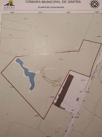
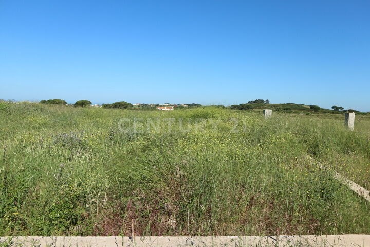
37 960 m²
CENA NIERUCHOMOŚCI OD M² MIASTA SĄSIEDZI
| Miasto |
Średnia cena m2 dom |
Średnia cena apartament |
|---|---|---|
| Sintra | 14 013 PLN | 10 729 PLN |
| Mafra | 14 383 PLN | 14 633 PLN |
| Dystrykt Lizboński | 14 330 PLN | 16 910 PLN |
| Alcabideche | 25 417 PLN | 17 959 PLN |
| Belas | 14 214 PLN | 11 957 PLN |
| Cascais | 18 984 PLN | 21 286 PLN |
| Cascais | 27 697 PLN | 27 679 PLN |
| Amadora | - | 12 051 PLN |
| Loures | 12 888 PLN | 13 591 PLN |
| Odivelas | 12 287 PLN | 13 618 PLN |
| Odivelas | 12 731 PLN | 14 100 PLN |
| Alfragide | - | 14 066 PLN |
| Linda a Velha | - | 21 362 PLN |
| Algés | - | 22 943 PLN |
| Loures | 12 727 PLN | 13 902 PLN |
| Lizbona | 27 880 PLN | 25 974 PLN |
| Torres Vedras | 8 378 PLN | 10 201 PLN |
| Almada | 12 392 PLN | 11 427 PLN |
| Vila Franca de Xira | 10 578 PLN | 10 666 PLN |
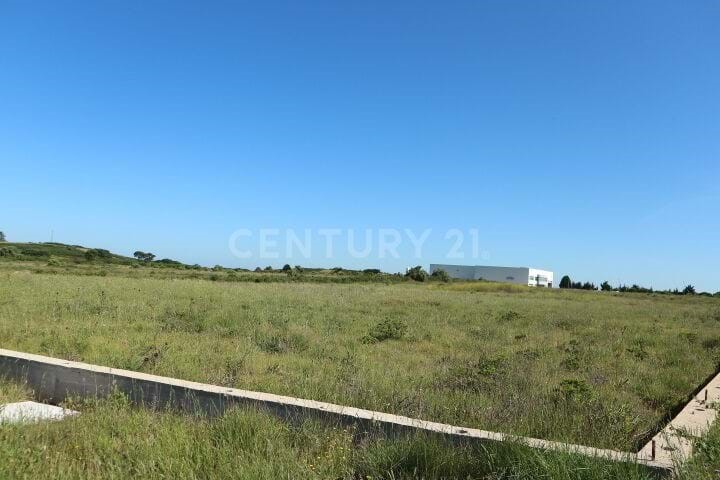
Ideal location for the Automobile Industry; Pharmacists; E-commerce; Logistics; Hypermarket; Car inspection; Senior or other clinics.
Existence of support infrastructure:
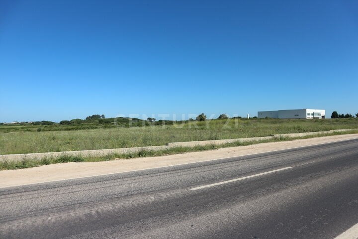
1. Road access: the Nascente is flanked by Avenida 11 de Junho, properly paved, serving the buildings present. To the north it is served by a path that allows access to the surrounding rural and urban buildings.
2. Water Supply: provided by SMAS;
3. Electricity Network: provided by EDP;
4. Telecommunications network: provided by PT;
Urban Structure:
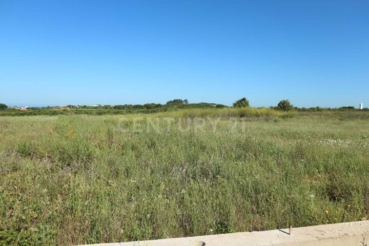
1. Good sun exposure;
2. Slight slope oriented along the north-south line;
3. Good road accessibility;
4. Served with basic infrastructure (water supply network; telecommunications; electricity network, urban garbage collection);
Classification of the PDM (Municipal Master Plan), the land under analysis has two classifications:
1. Rustic Soil (agricultural space): 40%
2. Urban Land (space for economic activities): 60%
Urban Indicators:
1. Area inserted in Urban Land (economic activity) 24,000.00 m2
2. Construction Area (Floor 1): 8,000.00 m2
3. Construction Area (Floor 1 + Floor 2): 10.000.00 m2
4. Use rate (viable): 0.40
5. Permeability rate: = 0.30
6. Ceiling (maximum): 9.00 m
7. Parking (according to AC = 10.000m2), minimum parameters for parking allocation:
Private, free, and public use ; Total: 84 parking spaces
Heavy parking (1place / 500m2 AC); Total: 20 parking spaces
Total: 104 parking spaces Zobacz więcej Zobacz mniej O terreno em questão tem uma área total de 37.920 m2 e está classificado como Espaços Industriais no Plano Diretor Municipal (PDM) de Sintra, mais especificamente no Artigo nº 157 da Secção EE da União das Freguesias de S. João das Lampas e Terrugem.Este terreno é considerado ideal para várias atividades económicas, como Indústria Automóvel, Farmacêutica, E-commerce, Logística, Hipermercado, Inspeção de carros, Clínicas Sénior ou outras.Existem infraestruturas de apoio disponíveis no local, tais como:
1. Acesso viário: O terreno é ladeado pela Avenida 11 de Junho, que é devidamente asfaltada e serve as construções presentes. Ao norte, há um caminho que permite acesso aos prédios rústicos e urbanos envolventes.
2. Abastecimento de Água: Assegurado pelos SMAS (Serviços Municipalizados de Água e Saneamento).
3. Rede Elétrica: Encontram-se assegurada pela EDP.
4. Rede de Telecomunicações: Encontra-se assegurada pela PT (Portugal Telecom).Além disso, o terreno possui um bom enquadramento urbanístico, com boa exposição solar, ligeiro declive orientado de norte a sul e boa acessibilidade rodoviária. Também é servido por infraestruturas básicas, como rede de abastecimento de água, telecomunicações, rede elétrica e recolha de resíduos urbanos.Em termos de classificação no PDM, o terreno tem duas classificações: 40% de Solo Rústico (espaço agrícola) e 60% de Solo Urbano (espaço de atividades económicas).Quanto aos indicadores urbanísticos do terreno, tem-se o seguinte:
1. Área inserida em Solo Urbano (atividade económica): 24.000,00 m2
2. Área de Implantação (Piso 1): 8.000,00 m2
3. Área de Construção (Piso 1 + Piso 2): 10.000,00 m2
4. Índice de Utilização: 0,40
5. Índice de Permeabilização: = 0,30
6. Cércea (máxima): 9,00 m
7. Parqueamento automóvel (em função da Área de Construção): Total de 104 lugares, distribuídos entre privado, uso livre e público (84 lugares) e pesados (20 lugares).Porque escolher a CENTURY 21 Polo Central II para comprar ou vender o seu imóvel:- Profissionais versáteis e altamente assertivos na identificação das necessidades efetivas dos nossos clientes;- Equipa e staff experiente e com extenso conhecimento no mercado, que lhe assegura eficácia na prestação de serviços imobiliários personalizados;- Acompanhamento processual durante toda a transação, para lhe garantir mais segurança nos processos burocráticos;- Serviços de intermediação de crédito;- Especialistas em crédito habitação, que lhe oferecem as melhores soluções de financiamento;- Intermediário de Crédito Vinculado Mutuantes "NOVO BANCO, SA BANCO BPI, SA BANCO SANTANDER TOTTA, SA CAIXA GERAL DE DEPÓSITOS, SA BANCO CTT, SA BANKINTER, SA - SUCURSAL EM PORTUGAL UNION DE CRÉDITOS INMOBILIÁRIOS, S.A., ESTABLECIMIENTO FINANCIERO DE CRÉDITO (SOCIEDAD UNIPERSONAL) - SUCURSAL EM PORTUGAL. Registo junto ao Banco de Portugal sob o Nº 0006057.
Contacte-nos estamos à sua espera! Land with 37,920 m2, is considered Industrial Spaces in the Sintra PDM. Article nº 157 of the EE Section of the Union of Parishes of S. João das Lampas and Terrugem.
Ideal location for the Automobile Industry; Pharmacists; E-commerce; Logistics; Hypermarket; Car inspection; Senior or other clinics.
Existence of support infrastructure:
1. Road access: the Nascente is flanked by Avenida 11 de Junho, properly paved, serving the buildings present. To the north it is served by a path that allows access to the surrounding rural and urban buildings.
2. Water Supply: provided by SMAS;
3. Electricity Network: provided by EDP;
4. Telecommunications network: provided by PT;
Urban Structure:
1. Good sun exposure;
2. Slight slope oriented along the north-south line;
3. Good road accessibility;
4. Served with basic infrastructure (water supply network; telecommunications; electricity network, urban garbage collection);
Classification of the PDM (Municipal Master Plan), the land under analysis has two classifications:
1. Rustic Soil (agricultural space): 40%
2. Urban Land (space for economic activities): 60%
Urban Indicators:
1. Area inserted in Urban Land (economic activity) 24,000.00 m2
2. Construction Area (Floor 1): 8,000.00 m2
3. Construction Area (Floor 1 + Floor 2): 10.000.00 m2
4. Use rate (viable): 0.40
5. Permeability rate: = 0.30
6. Ceiling (maximum): 9.00 m
7. Parking (according to AC = 10.000m2), minimum parameters for parking allocation:
Private, free, and public use ; Total: 84 parking spaces
Heavy parking (1place / 500m2 AC); Total: 20 parking spaces
Total: 104 parking spaces